PrimeMap LogoPrimeMap
Explore

Lost Places in the UK

Updated November 2026

Abandoned quarries, mines and airfields tell the story of how Britain worked and fought. In Snowdonia the terraces of Dinorwic slate quarry rise above Llanberis, in Cornwall the engine house of Wheal Coates stands on the cliffs.

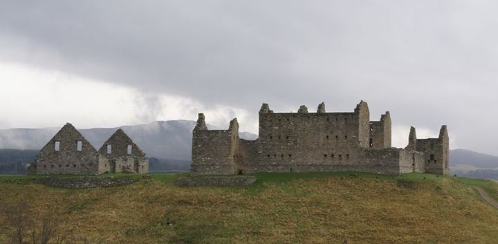
Ruthven Barracks in the Highlands recall the Jacobite risings, and many Second World War airfields lie quiet today. Please never enter private sites without permission and always mind your safety.

PrimeMap lists 213 lost places in the UK. Here are some of the best known.

How to find them

In the free PrimeMap app you will find all 213 places from this page on the map, with descriptions, photos and directions. Open the map wherever you are and see what is nearby.


App StoreGoogle Play
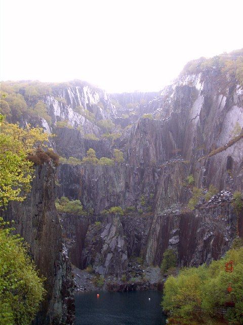
Dinorwic Quarry
Photo: nantcoly · CC BY-SA 2.0 · Wikimedia Commons

Dinorwic Quarry

📍 Llanberis, Gwynedd

Dinorwic quarry ( din-OR-wig; Welsh: [dɪˈnɔrwɪɡ]; also known as Dinorwig quarry) is a large former slate quarry, now home to the Welsh National Slate Museum, located between the villages of Llanberis and Dinorwig (formerly Dinorwic) in Wales.

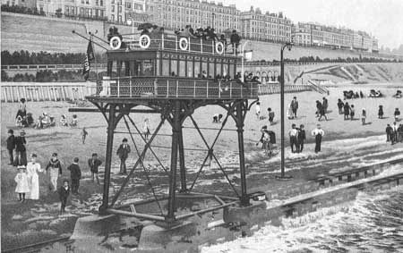
Brighton and Rottingdean Seashore Electric Railway
Photo: Unknown authorUnknown author · Public domain · Wikimedia Commons

Brighton and Rottingdean Seashore Electric Railway

📍 Peacehaven, East Sussex

The Brighton and Rottingdean Seashore Electric Railway was a unique coastline railway in Brighton, England, that ran through the shallow coastal waters of the English Channel between 1896 and 1901.

Ruthven Barracks
Photo: Otter · CC BY-SA 3.0 · Wikimedia Commons

Ruthven Barracks

📍 Kingussie, Highland

Ruthven Barracks (), near Ruthven in Badenoch, Scotland, are the best preserved of the four barracks built in 1719 after the 1715 Jacobite rising. Set on an old castle mound, the complex comprises two large three-storey blocks occupying two sides of the enclosure, each with two rooms per floor.

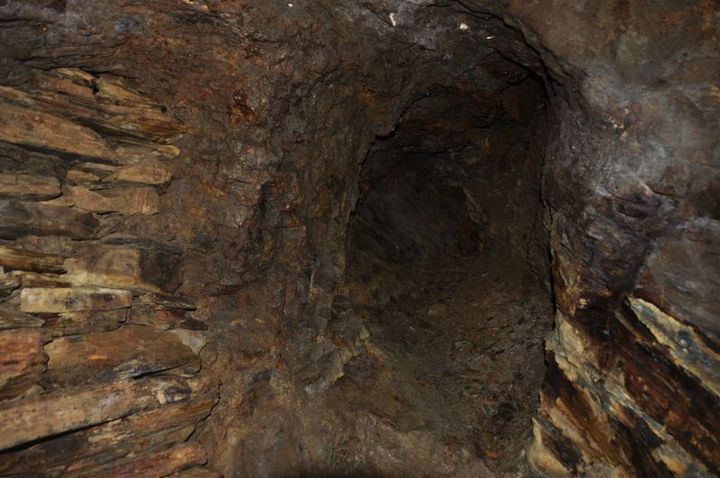
Dolaucothi Gold Mines
Photo: Nilfanion · CC BY-SA 4.0 · Wikimedia Commons

Dolaucothi Gold Mines

📍 Carmarthenshire

The Dolaucothi Gold Mines (pronounced [ˌdɔlaiˈkɔθɪ]; Welsh: Mwynfeydd Aur Dolaucothi) (grid reference SN662403), also known as the Ogofau Gold Mine, are ancient Roman surface and underground mines located in the valley of the River Cothi, near Pumsaint, Carmarthenshire, Wales.

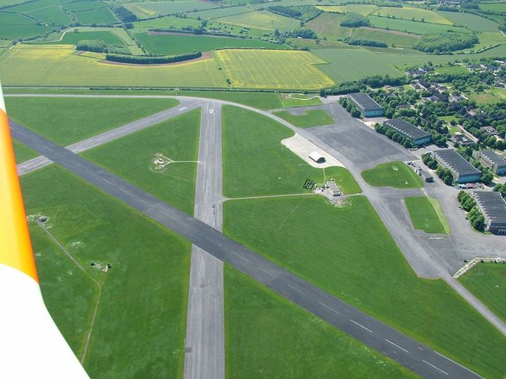
RAF Little Rissington
Photo: Eltep at English Wikipedia · Public domain · Wikimedia Commons

RAF Little Rissington

📍 Cotswold District, Gloucestershire

Royal Air Force Little Rissington or more simply RAF Little Rissington (ICAO: EGVL) is a Royal Air Force satellite station in Gloucestershire, England. It was once home to the Central Flying School, the Vintage Pair and the Red Arrows. Built during the 1930s, the station was opened in 1938 and closed in 1994.

Inchindown oil tanks
Photo: Rod Lightbody · CC BY-SA 2.0 · Wikimedia Commons

Inchindown oil tanks

📍 Invergordon, Highland

The Inchindown oil tanks is a disused underground oil depot in Invergordon, Ross-shire, Scotland. The tanks hold the record for the longest reverberation in any man-made structure, surpassing the Hamilton Mausoleum in 2014.

Wheal Coates
Photo: N p holmes · CC BY-SA 3.0 · Wikimedia Commons

Wheal Coates

📍 Cornwall

Wheal Coates is a former tin mine situated on the north coast of Cornwall, UK, on the cliff tops between Porthtowan and St Agnes. It is preserved and maintained by the National Trust.

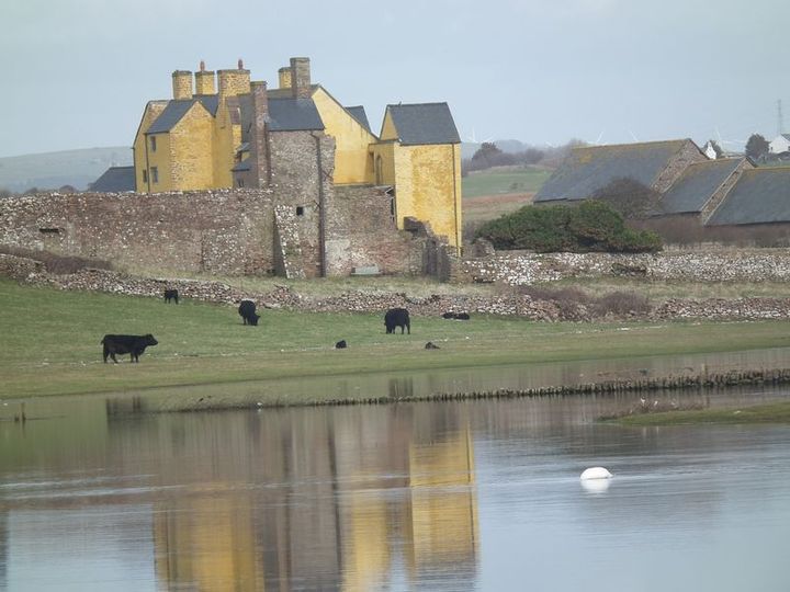
Sker House
Photo: BARRIE TRIGG · CC BY-SA 2.0 · Wikimedia Commons

Sker House

📍 Porthcawl, Bridgend County Borough

Sker House is a historic building in Wales. Originally built as a monastic grange of the Cistercian order over 900 years ago, it is situated just outside the town of Porthcawl, near Bridgend. Little remains of the original structure and it was completely rebuilt in the late sixteenth century.

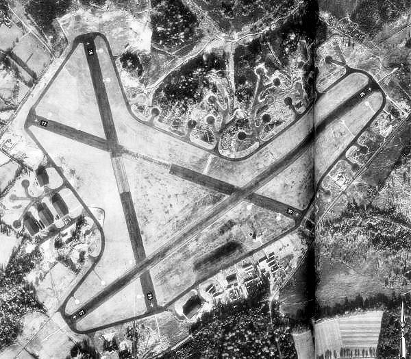
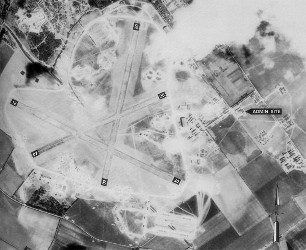
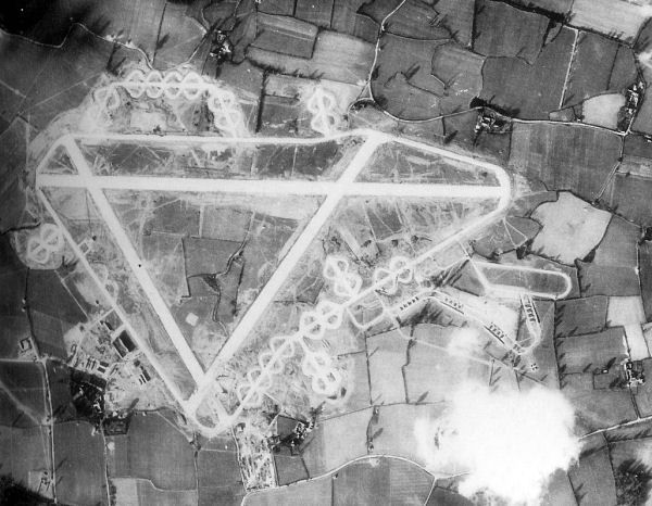
RAF Beaulieu
Photo: British Government · Public domain · Wikimedia Commons

RAF Beaulieu

📍 New Forest, Hampshire

Royal Air Force Beaulieu or more simply RAF Beaulieu ( BEW-lee) is a former Royal Air Force station in the New Forest, Hampshire, England. It was also known as Beaulieu airfield, Beaulieu aerodrome and USAAF Station AAF 408.

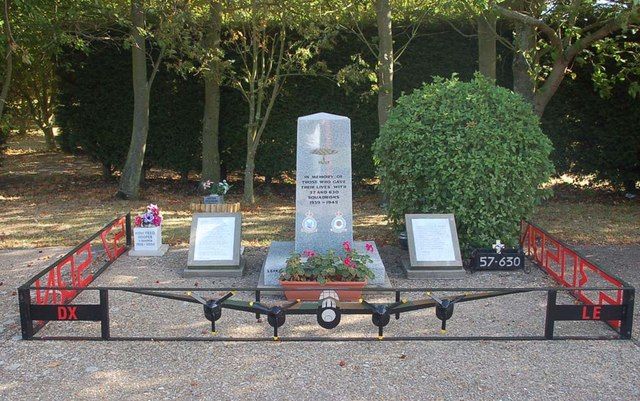
RAF East Kirkby
Photo: gary radford · CC BY-SA 2.0 · Wikimedia Commons

RAF East Kirkby

📍 East Lindsey, Lincolnshire

Royal Air Force East Kirkby or more simply RAF East Kirkby is a former Royal Air Force station near the village of East Kirkby, south of Horncastle in Lincolnshire, just off the A155. The airfield is now home to the Lincolnshire Aviation Heritage Centre.

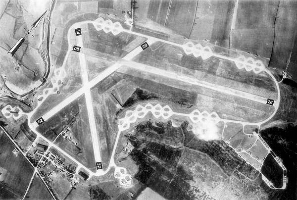
RAF Holmsley South
Photo: British Government · Public domain · Wikimedia Commons

RAF Holmsley South

📍 New Forest, Hampshire

Royal Air Force Holmsley South or more simply RAF Holmsley South is a former Royal Air Force station in Hampshire, England. The airfield is located approximately 5 miles (8.0 km) northeast of Christchurch, Dorset. Opened in 1942, it was used by both the Royal Air Force and United States Army Air Forces.

RAF Chilbolton
Photo: Royal Ordinance Survey · Public domain · Wikimedia Commons

RAF Chilbolton

📍 Test Valley, Hampshire

Royal Air Force Chilbolton or RAF Chilbolton is a former Royal Air Force station in Hampshire, England. The airfield was located in Chilbolton approximately 4 miles (6.4 km) south-southeast of Andover. Opened in 1940, it was used by the Royal Air Force and later by the United States Army Air Forces.

RAF Spanhoe
Photo: British Government · Public domain · Wikimedia Commons

RAF Spanhoe

📍 North Northamptonshire

Royal Air Force Spanhoe or more simply RAF Spanhoe (also known as Harringworth or Wakerley) is a former Royal Air Force station near Uppingham in Northamptonshire, England.

Torry Battery
Photo: Stanley Howe · CC BY-SA 2.0 · Wikimedia Commons

Torry Battery

📍 Aberdeen City

The Torry Battery (formerly referred to as Torry Point Battery) is an artillery battery near Torry in Aberdeen, Scotland, which has overlooked the city's harbour since 1860. It was originally constructed for nine guns with a defensible barracks at the rear.

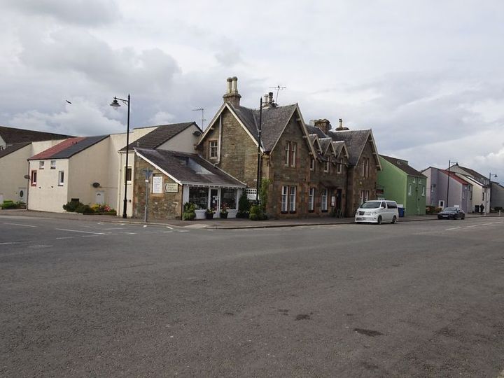
Kirkcudbright Railway
Photo: Nigel Thompson · CC BY-SA 2.0 · Wikimedia Commons

Kirkcudbright Railway

📍 Kirkcudbright, Dumfries and Galloway

The Kirkcudbright Railway was a railway branch line linking Kirkcudbright to the Castle Douglas and Dumfries Railway at Castle Douglas. It opened in 1864, and closed in 1965.

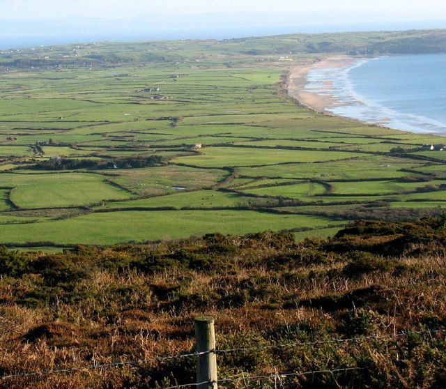
RAF Hell's Mouth
Photo: Eric Jones · CC BY-SA 2.0 · Wikimedia Commons

RAF Hell's Mouth

📍 Gwynedd

Royal Air Force Hell's Mouth, or more simply RAF Hell's Mouth, is a former Royal Air Force air gunnery and bombing range. It was initially redeveloped into a Relief Landing Ground, and then became an Emergency Landing Ground.

Melingriffith Tin Plate Works
Photo: Dr Mary Gillham Archive Project · CC BY 2.0 · Wikimedia Commons

Melingriffith Tin Plate Works

📍 Cardiff

The Melingriffith Tin Plate Works (also known as Melingriffith Tin and Iron Works; Welsh: Melingruffydd; meaning: "Griffith's Mill") were post medieval tin and iron works located on Tŷ-mawr Road, in Whitchurch, Cardiff, Wales.

Tranwell Airfield
Photo: User:Djmckee1 · Public domain · Wikimedia Commons

Tranwell Airfield

📍 Northumberland

Tranwell Airfield is a former airfield located 3.3 miles (5.3 km) southwest of Morpeth and 11.5 miles (18.5 km) north west of Newcastle upon Tyne, Tyne and Wear, England. The former airfield is the site of the former Royal Air Force Station Morpeth or simply RAF Morpeth which was an air gunnery school and was home to No.

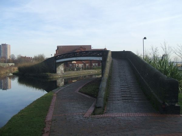
Bentley Canal
Photo: John M · CC BY-SA 2.0 · Wikimedia Commons

Bentley Canal

📍 Darlaston, West Midlands

The Bentley Canal is an abandoned canal that was part of the Birmingham Canal Navigations in England. A very short section still exists where it joins the Wyrley and Essington Canal in Wolverhampton.

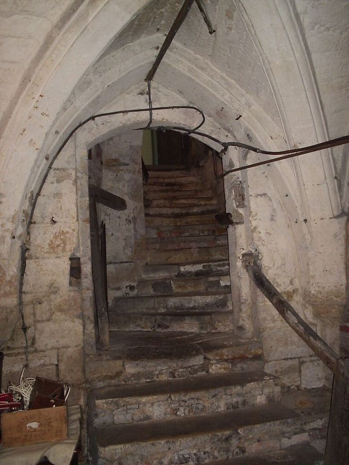
Tunnels of Northampton
Photo: The original uploader was Brookie at English Wikipedia. · CC BY-SA 3.0 · Wikimedia Commons

Tunnels of Northampton

📍 West Northamptonshire

According to some sources several tunnels run underneath the streets of the town of Northampton in England, along with many medieval cellars and ancient crypts. Much of the present town's development took place during medieval times, and some cellars from the period remain.

Eylesbarrow mine
Photo: Myself - Herby talk thyme · CC BY-SA 4.0 · Wikimedia Commons

Eylesbarrow mine

📍 South Hams, Devon

Eylesbarrow mine was a tin mine on Dartmoor, Devon, England that was active during the first half of the 19th century. In its early years it was one of the largest and most prosperous of the Dartmoor tin mines, along with Whiteworks and the Birch Tor and Vitifer mines.

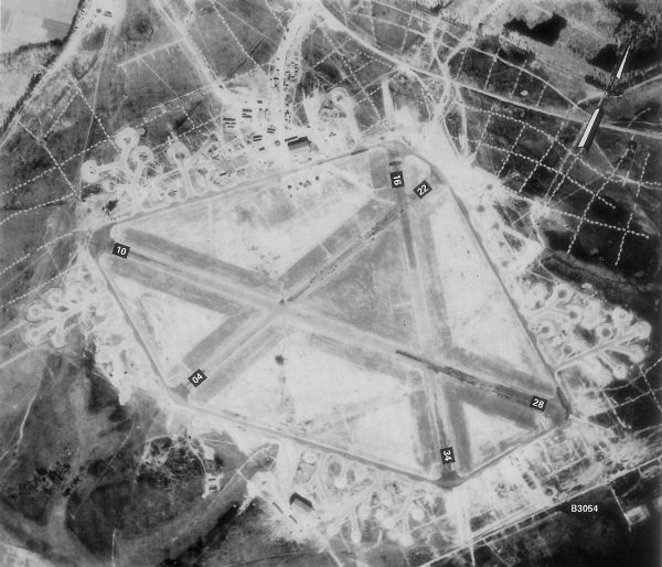
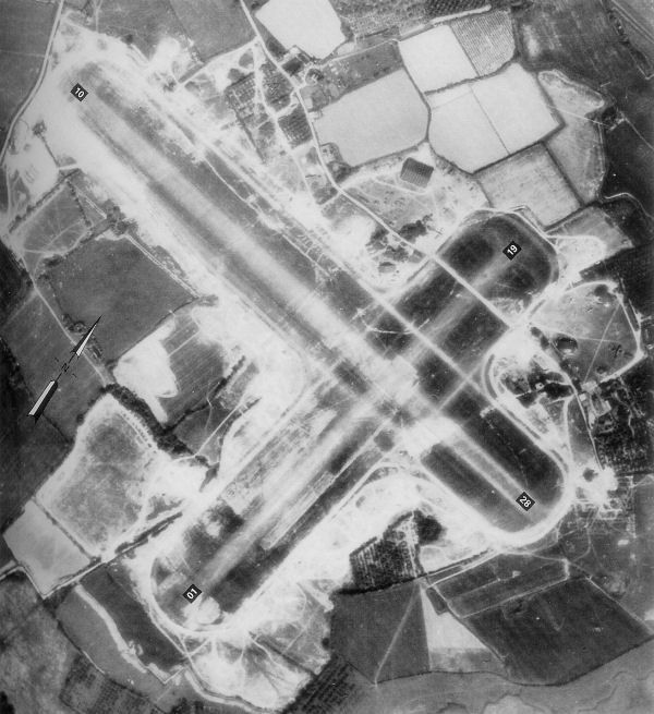
RAF Staplehurst
Photo: Photo: Royal Ordinance Survey Annotation: Freeman, Roger A., Airfields Of The Ninth, Then And Now, 1993. · Public domain · Wikimedia Commons

RAF Staplehurst

📍 Maidstone, Kent

Royal Air Force Staplehurst or more simply RAF Staplehurst is a former Royal Air Force Advanced Landing Ground located in Kent, England. The airfield is located approximately 1 mile (1.6 km) northeast of Staplehurst; about 38 miles (61 km) southeast of London.

Nailsea Glassworks
Photo: British School · Public domain · Wikimedia Commons

Nailsea Glassworks

📍 North Somerset

Nailsea Glassworks was a glass manufacturing factory in Nailsea in the English county of Somerset. The remaining structures have been designated as a scheduled monument. The factory making bottle glass and some window glass opened in 1788 and closed in 1873.

RAF Birch
Photo: British Government · Public domain · Wikimedia Commons

RAF Birch

📍 Colchester, Essex

Royal Air Force Birch or more simply RAF Birch is a former Royal Air Force station in Essex, England. The airfield is located 2 miles (3.2 km) northeast of Tiptree; about 43 miles (69 km) northeast of London Opened in 1942, it was used by both the Royal Air Force and United States Army Air Forces.

How to find them

In the free PrimeMap app you will find all 213 places from this page on the map, with descriptions, photos and directions. Open the map wherever you are and see what is nearby.
App StoreGoogle Play

Descriptions: shortened excerpts from Wikipedia, licensed CC BY-SA 4.0. Photos: Wikimedia Commons, author and licence shown with each image. Locations: © OpenStreetMap contributors.

← All Explore pages