PrimeMap LogoPrimeMap
Explore

Viewpoints in the UK

Updated November 2026

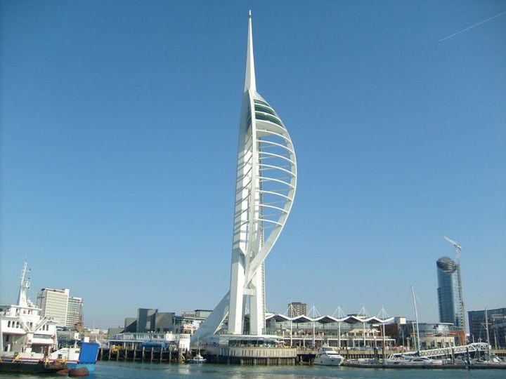
Some views are worth the climb. Blackpool Tower and the Spinnaker Tower in Portsmouth offer wide views over the sea, King Alfred’s Tower near Stourhead over the Wiltshire countryside.

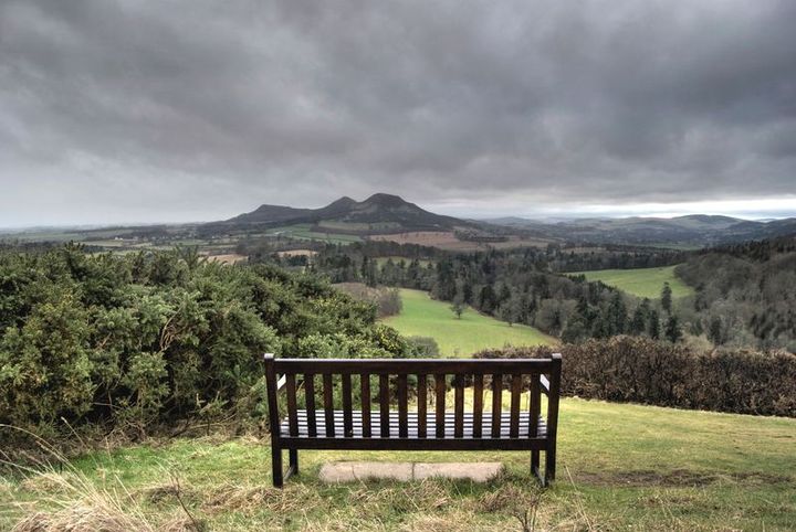
Out in the hills and on the coast you will find Sutton Bank on the edge of the North York Moors, Scott’s View in the Scottish Borders and Neist Point at the western tip of Skye.

PrimeMap lists 929 viewpoints in the UK. Here are some of the best known.

How to find them

In the free PrimeMap app you will find all 929 places from this page on the map, with descriptions, photos and directions. Open the map wherever you are and see what is nearby.


App StoreGoogle Play
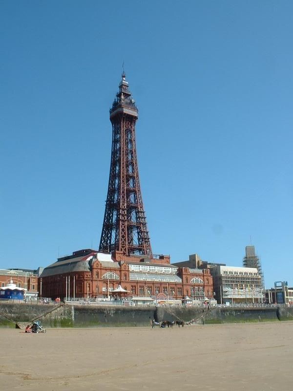
Blackpool Tower
Photo: The original uploader was OwlofDoom at English Wikipedia. · CC BY 1.0 · Wikimedia Commons

Blackpool Tower

📍 Blackpool, Borough of Blackpool

Blackpool Tower is a tourist attraction in Blackpool, Lancashire, England, which was opened to the public on 14 May 1894. When it opened, Blackpool Tower was the tallest man-made structure in the British Empire.

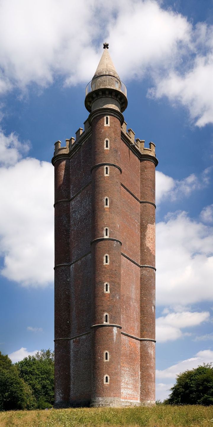
King Alfred's Tower
Photo: Jürgen Matern · CC BY-SA 3.0 · Wikimedia Commons

King Alfred's Tower

📍 Wincanton, Somerset

Alfred's Tower is a folly in Somerset, England, on the edge of the border with Wiltshire, on the Stourhead estate. The tower stands on Kingsettle Hill and belongs to the National Trust.

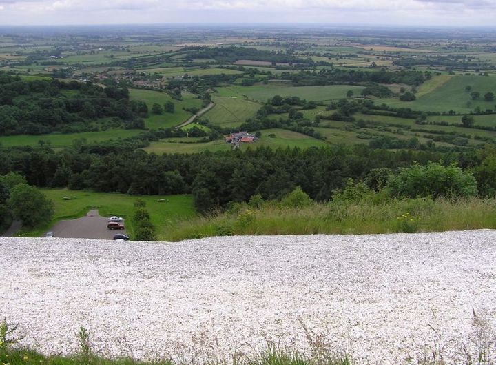
Sutton Bank
Photo: Afterbrunel · Public domain · Wikimedia Commons

Sutton Bank

📍 North Yorkshire

Sutton Bank is a hill in the civil parishes of Cold Kirby and Sutton-under-Whitestonecliffe in the English county of North Yorkshire. It is a high point on the Hambleton Hills, with extensive views over the Vale of York and the Vale of Mowbray, and is in the North York Moors National Park.

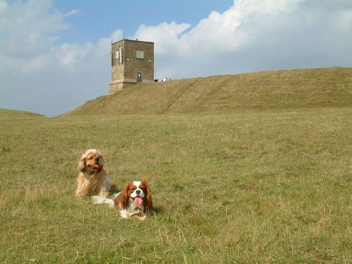
Bredon Hill
Photo: The original uploader was StephenDawson at English Wikipedia. · CC BY-SA 2.0 · Wikimedia Commons

Bredon Hill

📍 Wychavon, Worcestershire

Bredon Hill is a hill located in Worcestershire, England, south-west of Evesham in the Vale of Evesham. The summit of the hill is in the parish of Kemerton, and it extends over parts of eight other parishes (listed below).

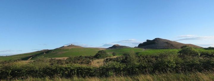
Northumberlandia
Photo: AWhiteC · CC0 · Wikimedia Commons

Northumberlandia

📍 Bedlington, Northumberland

Northumberlandia (the "Lady of the North") is a huge land art sculpture in the shape of a reclining female figure, which was completed in 2012, near Cramlington, Northumberland, northern England. It is in the care of Northumberland Wildlife Trust.

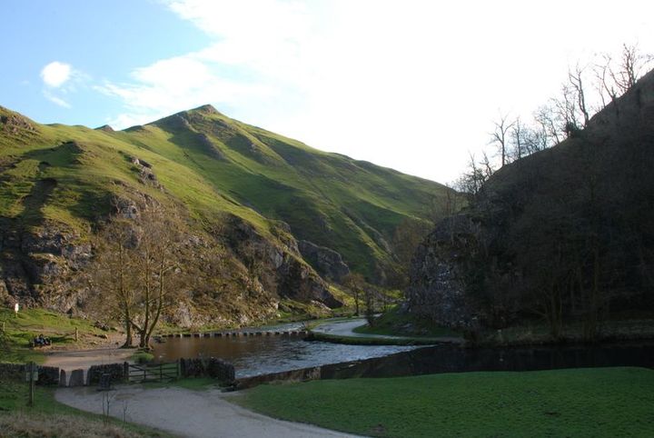
Thorpe Cloud
Photo: Rob Bendall (Highfields) · Attribution · Wikimedia Commons

Thorpe Cloud

📍 Derbyshire Dales, Derbyshire

Thorpe Cloud is an isolated limestone hill (a reef knoll) lying between the villages of Thorpe and Ilam on the Derbyshire/Staffordshire border at the southern end of Dovedale. The name "cloud" derives from the Old English word clud which means "hill".

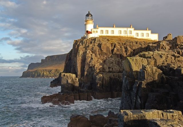
Neist Point
Photo: John Allan · CC BY-SA 2.0 · Wikimedia Commons

Neist Point

📍 Highland

Neist Point (Scottish Gaelic: Rubha na h-Eist) is a viewpoint on the most westerly point of Skye. Neist Point Lighthouse has been located there since 1909.

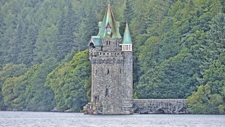
Lake Vyrnwy Straining Tower
Photo: Gary Beale · CC BY-SA 4.0 · Wikimedia Commons

Lake Vyrnwy Straining Tower

📍 Powys

The Straining Tower at Lake Vyrnwy is an intake tower built to extract water from the lake. The tower stands on the north shore of Lake Vyrnwy, near the village of Llanwddyn, in Powys, Wales.

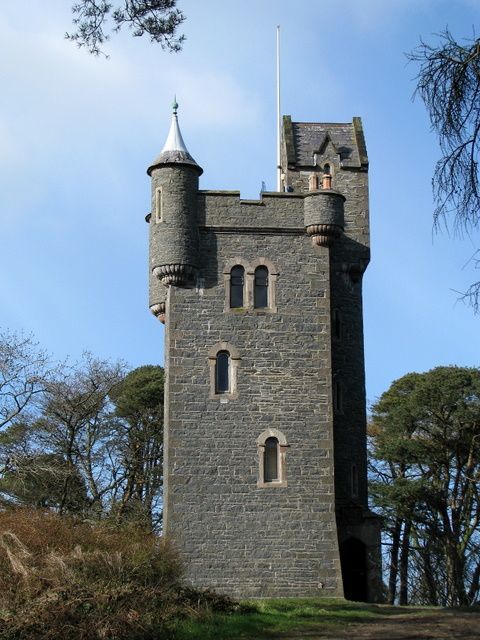
Helen's Tower

Helen's Tower

📍 Newtownards, County Down

Helen's Tower is a 19th-century folly and lookout tower in Conlig, County Down, Northern Ireland. It was built by 5th Lord Dufferin and Clandeboye and named for his mother, Helen.

Scott's View
Photo: Ruy Lestrade (www.flickr.com/semi-detached) · CC BY-SA 3.0 · Wikimedia Commons

Scott's View

📍 Melrose, Scottish Borders

Scott's View is a viewpoint in the Scottish Borders, overlooking the valley of the River Tweed, which is reputed to be one of the favourite views of Sir Walter Scott. The viewpoint can be located directly from a minor road leading south from Earlston just off the A68 and by travelling north from the village of St.

St Paul's Tower
Photo: ThomasB443 (talk) · Public domain · Wikimedia Commons

St Paul's Tower

📍 Sheffield, South Yorkshire

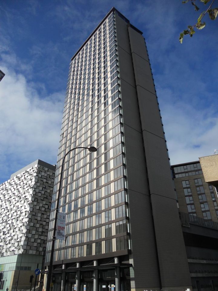
St Paul's Tower is a skyscraper located on Arundel Gate in Sheffield, South Yorkshire, England. Construction commenced in May 2006 and the building was topped out in August 2010, surpassing Sheffield University's Arts Tower as the tallest building in Sheffield at 101 metres (331 ft) tall.

Spinnaker Tower
Photo: Unisouth · CC BY 3.0 · Wikimedia Commons

Spinnaker Tower

📍 Portsmouth

The Spinnaker Tower is a 170-metre (560 ft) landmark observation tower in Portsmouth, England. It is the centrepiece of the redevelopment of Portsmouth Harbour, which was supported by a National Lottery grant.

Uig Tower
Photo: Otter · CC BY-SA 3.0 · Wikimedia Commons

Uig Tower

📍 Highland

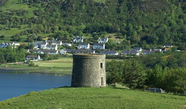
The Uig Tower, also known as Captain Fraser's Folly, is a nineteenth-century folly in Uig on the island of Skye in the Highlands of Scotland. It is a category B listed building.

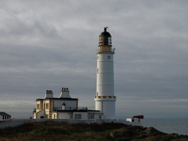
Corsewall Lighthouse
Photo: wfmillar · CC BY-SA 2.0 · Wikimedia Commons

Corsewall Lighthouse

📍 Dumfries and Galloway

Corsewall Lighthouse is a lighthouse at Corsewall Point, Kirkcolm near Stranraer in the region of Dumfries and Galloway in Scotland. First lit in 1817, it overlooks the North Channel of the Irish Sea. The definition of the name Corsewall is the place or well of the Cross. (...)

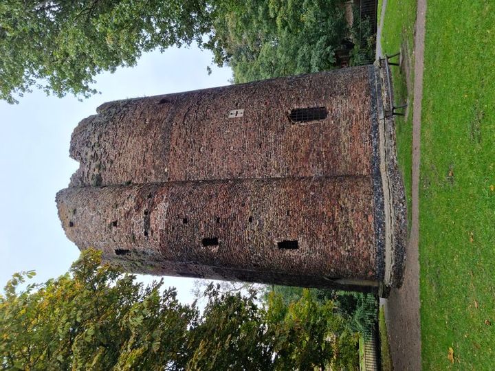
Cow Tower
Photo: Irid Escent · CC BY-SA 2.0 · Wikimedia Commons

Cow Tower

📍 Norwich, Norfolk

The Cow Tower is an artillery tower by the River Wensum in Norwich, Norfolk, England. Built between 1398 and 1399 by the city authorities in response to the threat from France and indigenous English rebels, the tower was intended to defend the north-eastern approach to Norwich with hand cannons and bombards.

How to find them

In the free PrimeMap app you will find all 929 places from this page on the map, with descriptions, photos and directions. Open the map wherever you are and see what is nearby.
App StoreGoogle Play

Descriptions: shortened excerpts from Wikipedia, licensed CC BY-SA 4.0. Photos: Wikimedia Commons, author and licence shown with each image. Locations: © OpenStreetMap contributors.

← All Explore pages