 PrimeMap
Four Places near Verum That Are Not What They Seem
One evening in July I walked four recorded sites in the woods around Verum in northern Skåne. All four have one thing in common: what you see in front of you tells a different story from what actually happened. A mound that looks ancient and dates from 1959. Carvings that look prehistoric and are from the 1940s. A vault you might take for a grave, where potatoes were stored. That is exactly why I like this area.
Smedlycke: a croft and its smithy
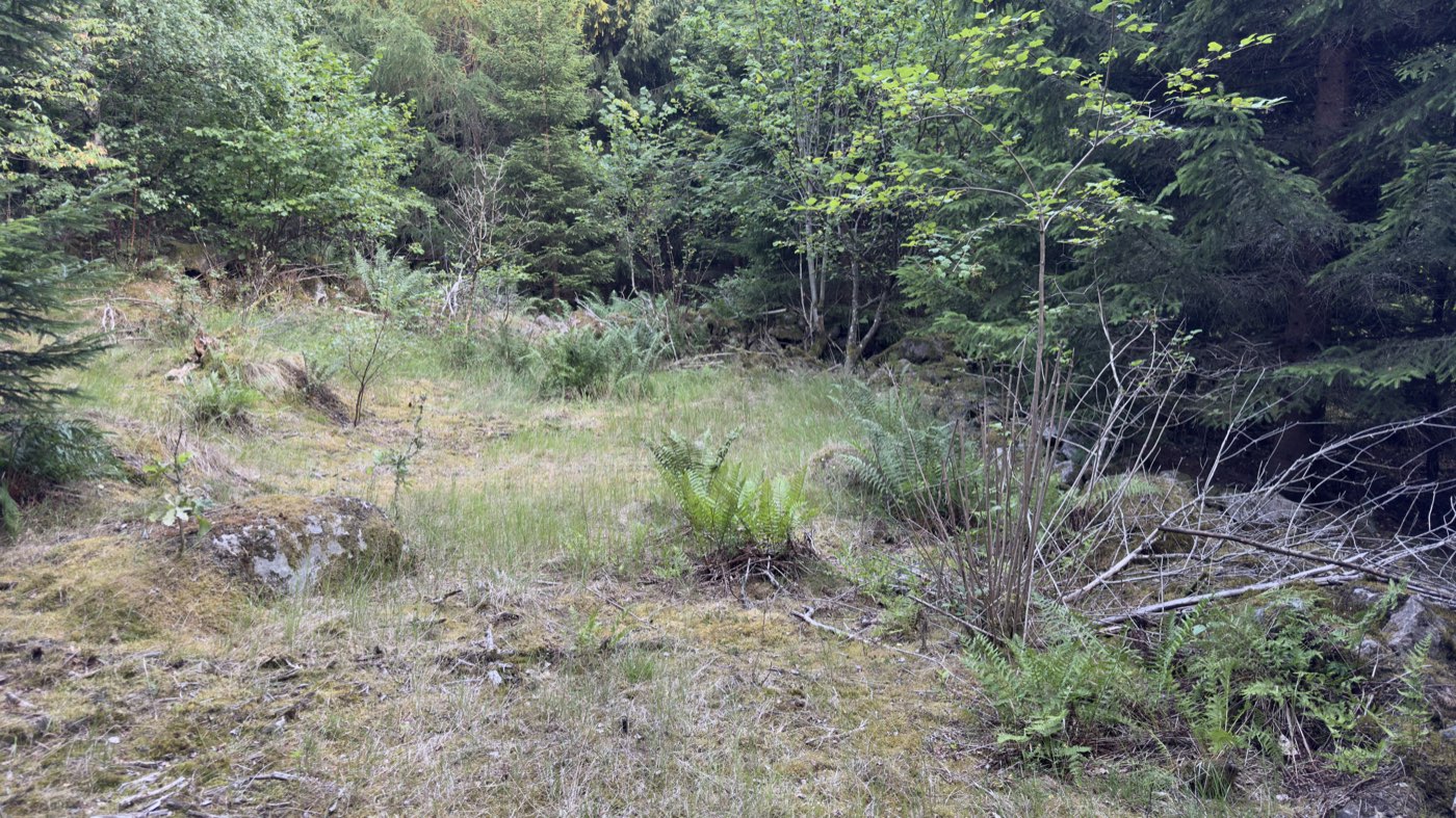
The first stop looks like nothing at all: a clearing, grass, spruce all around. Only when you lower your eyes to the ground does it turn into a floor plan. The register records Smedlycke here, a croft ruin of 70 by 35 metres — a cottager's holding, not a farm, built on rented land.
The house foundation measures 11 by 11 metres, and in the middle of the west-south-west long side sits a substantial chimney base. That is always the point where a ruin like this becomes concrete: the chimney stood where the heating and cooking happened, and it is usually the last thing left of a timber house.
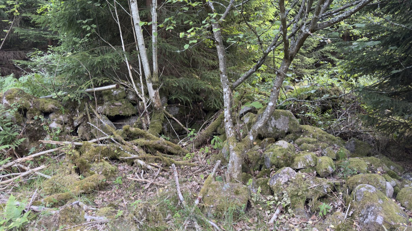
Furthest north, at a junction of tracks, lies a second substantial foundation — in the register's assessment a smithy, partly dug into the slope, with wall remains a metre thick. That is probably where the name comes from: smed is the smith. Around the house foundation a simple stone wall marks off the former infield, roughly 30 by 20 metres. Tiny. That was the size of a family's livelihood.
In writing the place turns up as early as 1682, in the tithe commission, spelled "Smelöcke" at the time.
About 250 metres further on, the register lists another site that I did not visit that evening and that has been nagging at me ever since: Korsabacken — a sacrificial cairn with no visible remains, and an oak memorial cross 2.2 metres high, originally raised in the 19th century and replaced since. The tradition attached to it is grim: a man from Farstorp parish was on his way to Skeinge mill with a sack of grain when he was set upon by acorn-fed swine, which mauled him so badly that he died. A second version says he was killed by a falling pine on a stormy autumn night. Two versions of the same death — and a cross that is right at the top of my list for next time.
The mass grave of Verum
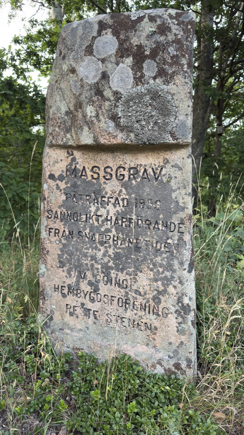
The second stop is the one where things go quiet. On a low mound stands a granite stone, 1.1 metres high, thickly grown with lichen. The inscription is still easy to read:
MASSGRAV
PÅTRÄFFAD 1959
SANNOLIKT HÄRRÖRANDE
FRÅN SNAPPHANETIDEN
V. GÖINGE HEMBYGDSFÖRENING
RESTE STENEN
In English: Mass grave, found in 1959, probably originating from the snapphane era. The West Göinge local heritage society raised the stone.
What happened in 1959 is in the register: the grave was struck during gravel extraction. A superficial archaeological investigation established a four-sided pit, about 2.5 by 2 metres, containing at least five individuals. Two bronze hooks were also found — of which the register notes laconically that they appear not to have been kept. Afterwards the mound was raised over the find, six metres across and one metre high, and the stone set on top of it.
That is the first false impression of the evening: the mound looks like a burial mound out of deep prehistory. It is from 1959. It is not the grave that is young — it is the packaging.
And the dating? The stone itself says sannolikt — probably. This is a local heritage society's assessment, not an established finding. But it is plausible, because the area has a history to match: after the Peace of Roskilde in 1658 Skåne passed from Denmark to Sweden, and during the Scanian War snapphanar resisted Swedish rule here — irregulars who were put down with great severity.
How close all this was is shown by the church of Verum, a good half-kilometre away. There, in 1677, a speech was given on the church hill after which several farmers signed an oath of loyalty to the Swedish king. Five minutes' walk between a mass grave and the place where loyalty was signed.
One footnote that fits none of the above and is nonetheless true: in that same village church, on 6 July 1971, Agnetha Fältskog and Björn Ulvaeus were married — two quarters of ABBA.
The carvings that look older than they are
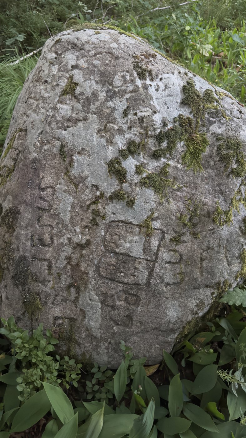
A few kilometres further on, in a patch of woodland, some 15 boulders with carvings lie across an area of roughly 30 by 20 metres. Moss grows in the grooves, the edges are soft, the motifs feel archaic. Standing there, you instinctively think: this must be old.
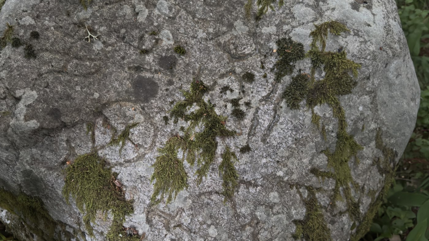
And this is exactly where it pays to read the small print. The site is listed in the register as "Ristning, medeltid/historisk tid" — "carving, medieval/historical period". That sounds like a dating, but it is not one: it is the type name of a category covering all carvings at farms, crofts and shielings, from the Middle Ages right through to modern times.
The actual information is in the description, and it is unambiguous: "sentida ristningar", recent carvings, some 15 of them, made during the 1940s by Bernhard Hillerström. This is confirmed by the official classification: the site counts as "övrig kulturhistorisk lämning" and not as a protected fornlämning — and it would only be protected if the carvings could be assumed to predate 1850.
Who Bernhard Hillerström was, I have not been able to find out. He does not appear in the artists' dictionaries, nor in regional sources. Apparently someone local who spent time in the 1940s working on stones in the forest — including, as the photograph shows, with religious motifs. There is nothing anywhere about deception; no indication that he wanted to pass anything off as ancient. Time did that entirely on its own: eighty years of moss and weather are enough to make fresh carvings look ancient.
Sjötorp: the cellar from 1638
The last stop lies barely a hundred metres from the carvings, and it is my favourite of the evening.
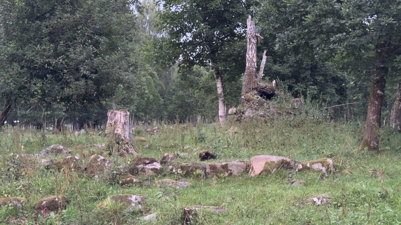
This was Sjötorpets gamla tomt, a farmstead site of about 90 by 50 metres. The house foundation shows in the grass, 22 by 7 metres, built of stones 30 to 70 centimetres across, again with a chimney base. According to the place-name records, the earliest written attestation of the name dates from 1638.
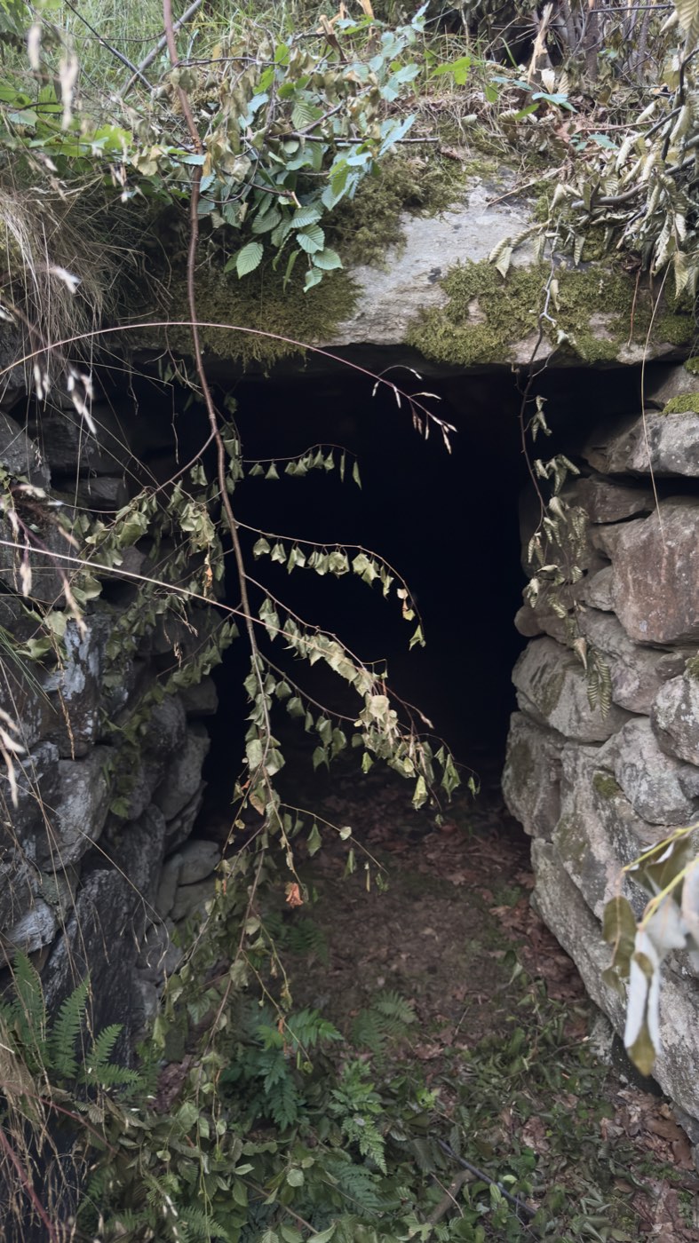
In the south-east stands the actual reason I drove out here. The register mentions it in passing as "a substantial root cellar" — jordkällare. What is set into the slope is a dark entrance, framed left and right by dry-stone walling, spanned by a heavy lintel with moss and birch twigs hanging over it.
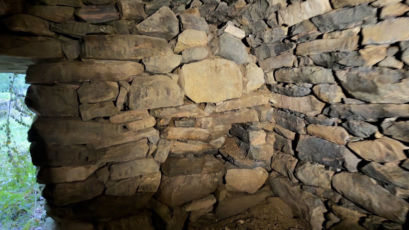
And inside it becomes clear what kind of craft this was. Flat stones laid cleanly in courses, without a drop of mortar, the walls drawn slightly inwards so that they carry each other. The thing has stood for generations, while of the dwelling house beside it only a line of stones in the grass remains.
So here is the second false impression, and the finest one: you stand in front of something that looks like a burial chamber — and you are in a storage cellar. Potatoes lay here, turnips, preserved things, frost-free in winter, cool in summer. No cult, no dead. Just people who had to get through the winter.
Why places like these
Four recorded sites in one evening, and not one of them is signposted. No car park, no trail, no information board. Anyone walking here sees a clearing, a few stones, a mound and a hole in a slope.
The tool that turns that into an evening full of stories is a map that knows these points. That is what I use the PrimeMap app for: it shows croft ruins, memorial stones, carvings and graves as their own pins — with the original description from the Swedish heritage register, translated into your language. And as the carvings of Verum show, it pays to look twice afterwards: the type name of a site is not the same thing as its age.
How far that can take you is in the story next door: a few kilometres south I found a wooden cross bearing only three letters — and found, in the parish register, the girl it stands for. She too died, like the man of Korsabacken, under a falling tree.
Find the stories on your doorstep
Over 680,000 archaeological sites, plus castles, ruins, memorial stones and forgotten places across Europe — with descriptions in your language. Free for iPhone & Android.

Sources: Riksantikvarieämbetet (Fornsök) — Smedlycke and Korsabacken (Farstorp parish), Minnesmärke/Begravningsplats Verum, Ristning L1990:7123 (RAÄ no. Verum 5:1) and Sjötorpets gamla tomt · RAÄ, definition of the site type "Ristning, medeltid/historisk tid" · Wikipedia on Verums kyrka · own photographs, 18 July 2026.